Walks into the nature
Walking in Rhodes nature will be a highly enjoyable and revealing experience. Choose a clear, sunny day and take any of the routes as suggested by the Greek National Tourist Organisation (GNTO). Walkers will be amazed by the wealth of flora: Wild flowers, aromatic herbs, bushes, and coniferous forests with pines, cypress and cedar. There are walking tours with maps, measured trip duration, detailed descriptions grouped according to their difficulty.
A walk from the Valley of Butterflies to Agios Soulas and the village of Soroni
The total distance of this walk is 17 km (10,5 mi). The expected duration in a pace of 6 km per hour is 3 h. The grade can be described as moderate. Most of the walk is along a wide forestry track. The twenty-minute stretch linking the Kalopetra Monastery and the forestry track is uphill and on a fairly steep, rough path.
You will need sturdy shoes or boots, sunhat, sunglasses, long-sleeved shirt, long trousers, cardigan, anorak, raincoat, raingear, water. How to get there: Bus to Petaloudes. To return: Buses depart Soroni, journey to Rodos City takes 45 min.
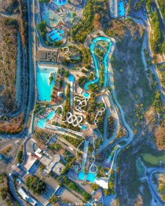
Petaloudes – the butterfly valley – is as much a part of Rodos as the three notable ruins of Lindos, Filerimos and Kamiros. Perhaps it’s even more of a mystery: no one seems to know exactly where the butterflies come from or how long they’ve been here. So join the hordes for half an hour and see the obligatory – deservedly so – Petaloudes. Exuberant vegetation floods the valley floor.
Just walking beside the stream here is a unique experience. But it’s the presence of this myriad of butterflies that has made Petaloudes the island’s natural treasure. When you’ve left this valley behind, you have the countryside to yourself and a few wild goats. You ascend the island’s spine. Strawberry trees, tangled with bushes and scrub, wood the inclines. As you wind along the crests, your views will sweep down into the guilies and beyond the plains to the sea. On your descent to the plains, pines keep you company, until they give way to olive groves. As you approach the homeward stretch, you’ll come to Agios Soulas, the site of one of the island’s biggest festivals. Here the park-like setting comes alive on the 30th of July, when the grounds surrounding the little chapel are the scene of athletic events, dancing, even horse-racing!
The walk begins just at the entrance to the Butterfly Valley. Before you start out, however, be sure to visit the part of the valley below the bridge. It’s not to be missed. The steps beside the ticket office/gate lead you down to it and eventually to a bar/restaurant. Visit this part of Petaloudes first, and then return to the upper valley. From here, wind your way up the gorge, alongside a cascading stream. Only a flicker of sunlight penetrates the thick foliage. Little wooden bridges cross the still pools, steps climb the rock walls and the butterflies pattern the tree trunks in odd paislies. July to September is the best time to see this great deluge of butterflies (Callimorpha quadripunctaria). They’re attracted to the valley by the strong resinous scent of the thorax tree.
Less than ten minutes up, a sign tells you that the valley has come to an end and to return. But you continue up the steps, above the fails. This short stretch is the most beautiful part of the park for me.
Five minutes later we climb above another waterfall and head along a dry streambed. There’s no concrete pathway now! Almost immediately, you leave the streambed and continue over to the left. Here you’ll find red dots – the trail markers. In half a minute you’re crossing a side-stream and scrambling up a steep hill. Just over 15 min from the entrance to the park, you’re out in a clearing with olive trees. You’ll see a chapel, the Kalopetra Monastery (built in 1784), not far above. From here you look down through the valley on to the coastal plain. From the monastery, head down the macadam road. Three minutes along, on a curve, you’ll see a low cypress tree on the roadside on your right. If you look closely, it has a red arrow on its trunk. just across the road from it, a path ascends the ridge running down on your left. Follow it, keeping left and up.
Breasting the crest, two minutes up, the way swings left. Thyme, Spanish broom, Cistus and sage flank the path. Shortly you’re passing through strawberry trees, dots keeping you on the trail. Ten minutes up there’s an unimpeded view of the west coast. Minutes up from here an arrow points you on up the ridge, slightly left. Twenty minutes past the monastery you attain the vertex of the ridge dividing east and west. There’s a splendid panorama. The greens roll down into browns, which in turn meet the blues of the sea. Profitis llias is the sombre mountain over to your left. Beyond it is Atavyros, the island’s highest point.
From the crest we leave the red dots and arrows. Head to the right, along a faint track passing below the crest (the short walk heads left here). Just over five minutes on, when the track forks, keep right. In three minutes you’ll join the main forestry track (under 30 min). Turn right. As it twirls around the knolls, you’ll pass two tracks branching off to the right. Up here, the cool north-west breeze swishes off to the east, trailing whiffs of sage and thyme.
Forty-five minutes from the monastery (1 h 05 min into the walk) we’re looking out on to the thinning tail of Profitis llias, and, below it, the sheltered valley of Dimilia. To the west, forest reappears, spreading across the abrupt hills. Facing the sea, a wide, open valley reveals the Soroni plain. A little further on – at the 1 h 10 min mark, you leave the main track and head for the sea. The turn-off is the next right. This is a wide track, snaking its way down a narrow bumpy ridge towards the plains below. Ten minutes down, at a fork, head off right on to another lateral ridge. Five minutes later, fork right again, down to another ridge.
The Eleousa to Soroni road becomes your way one hour and fifty minutes from the monastery (2 h 10 min into the walk). Turn right. During the afternoon there’s very little traffic on this road. Ten minutes along you’ll probably be grateful for the water fountain on the roadside to the right.
If you’re not tiring at this point, and you’re ‘into’ chapels – or monasteries (moni), as the Greeks call them – you’ve another nearby. A little over five minutes from the water fountain a gravel track turns off to your right to Agios Georgios (signposted). About ten minutes along the track stands the chapel, built in 1830.
The main walk passes this detour and comes to Agios Soulas, set back off the road in a grove of eucalyptus, pines and cypress trees. Narrow tarred roads lead up to the chapel grounds, where there’s a bar/restaurant (only open in July), toilets, water fountains, a playground, and a race track. Yes, a race track. The most important event of the entire festival is the horse racing! The chapel itself is very simple.
Soroni lies another half an hour down the road, or 2h 55min into the walk. The bus stop is five minutes from the junction, to the right – opposite the bus shelter on the other side of the road. If you have a fairly long wait for the bus, why not go for a dip? Ten minutes down the road opposite the bus stop, there’s a pleasant stony beach with a couple of bar & restaurants.
An alternative shorter walk.
A moderate circular tour (1 h 20 min) starts and finishes at Petaloudes. Follow the main walk as far as the 40 min mark – to the viewpoint at the top of the crest. Here, when the main walk continues to the right on a faint track, the short walk heads down the track to the left. Ten minutes down this track, come to a junction: turn sharp left and head straight down. The Psinthos (macadam) road is met in five minutes. Turn left. A little over five minutes walking returns you to the Kalopetra Monastery. Here you can either rejoin the Petaloudes path we climbed at the start of the walk or continue down the road back to the bus stop (another twenty minutes). Equipment: sturdy shoes, sunhat, sunglasses, suncream, long-sleeved shirt, cardigan, picnic, water.
A walk from the village of Arhipoli to the village of Arhangelos
The total distance of this walk is 11km (6 1/4 mi). The expected duration in a pace of 6km per hour is 1 h 40 min. The grade can be described as easy. Walk is along a gravel track
Equipment: sturdy shoes, sunhat, sunglasses, long-sleeved shirt, long trousers, cardigan, raingear, raincoat and water. How to get there: Bus to Archipoli. To return: The return is from Archangelos, from where there are numerous buses
In fact, the best time to make this walk is late afternoon or early evening, when the countryside is bathed in a soft purple light. You’ll start out from the quiet hillside village of Archipoli, ascend a pass up into goat country, and step into a landscape right out of a classical painting. The air will be scented first with pines and then thyme. This scene is neither dramatic nor spectacular. It is simply perfection, and remains one of my most vivid walking memories.
So while the walk is ideal for beginners, it’s also ideal for the energetic. Simply tack it onto Alternative walk 7 and make a day’s outing of it. You will virtually cross the island. This does, however, leave a gap in the middle – the four kilometres between Eleousa and Archipoli. It can either be filled by a bus journey or walked. The road is sealed, but little used.
Start the walk in Archipoli. Head out of the village on the Kolymbia road. After 10 min walking, just past a sharp, descending S-bend, and just before a culvert, you’ll see a wide gravel track on your right. Turn onto it and gently climb between two forested ridges towards an enclosed valley. A small streambed, filled with plane trees, lies below the track. Oleander bushes splash pink along the valley floor. At 20 min into the walk come to a junction. Keep left and up. For the first thirty minutes walking, you’re enveloped in sweetly-scented pines. Then the trees slowly abate, yielding to a landscape of Launaea, thyme, sage and Spanish broom. Goats hop about the rocky crags of the ridge. At 45 min a track joins from the left and you begin the descent over the pass. The way gets rougher and more narrow.
At 50 min into the walk, through a gap in the hills, Archangelos and its Profitis llias (the mountain behind the village) come into view. Between here and there lie groves of flickering, silver-grey olive trees, catching the evening breeze. Squares and oblongs of freshly-harvested wheat fields patch the Plain. Under a retiring sun, this scene is perfection. A building and a water trough sit squeezed into the gap here between the ridges, overlooking this splendid view.
When you reach the olive groves below, the way swings back to the right, and minutes along you come to a junction. Keep straight on, passing a small building beside the track. You now meander through ageing olive trees. A few vineyards and fruit trees break the monotony of colour. Tethered donkeys bray out, seeking whatever attention they can get. You’ll see the farmers returning to the village. They generally stop and offer you a lift.
At about 1 h into the walk, you join a gravel track coming in from the right. A ‘shocking’ blue shrine on your left alerts you to it. Keep straight. Ten minutes along, this track forks; head left. For those running low on ‘walkers’ petrol’, there’s a water fountain two minutes past the fork. Then, without warning, ten minutes later, the way becomes tarred. You’ll cross the main Rhodes-Lindos road at 1 h 30 min and head into Archangelos. Continue straight on, across the road, bearing left. After crossing a small stream, keep right. At the T-junction, a minute on, right again, and you’re in the main street. The bus stop is just past the first alleyway heading into the houses, on your left. (Not the Stegna road, the next one.) But first you may have time to climb to the castle and admire the view!
Powered by GetYourGuide